
The other day a colleague told me about a bean field in Polk county, Minn., which catastrophically dropped 25 feet. After watching the video I noticed the land was located near a river, and the video points out that the land also seems to be pushing into the river. It made me wonder if some types of geographical features I had thought developed gradually over time instead occasionally occur all at once as this did. And now will this sunken area present to the river a path through which a new meander of the river may be created?
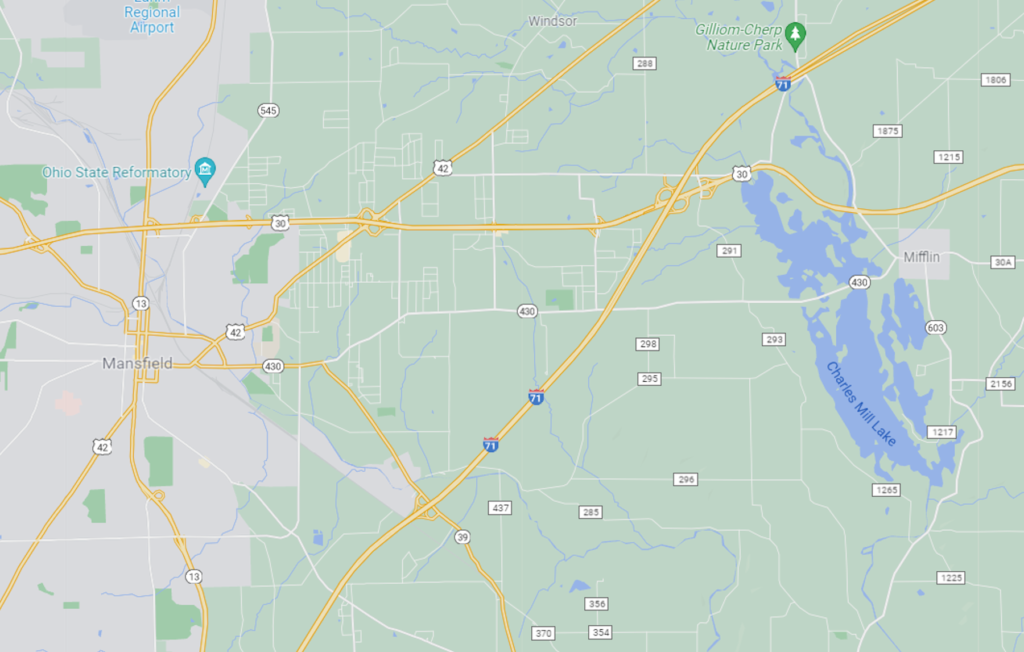
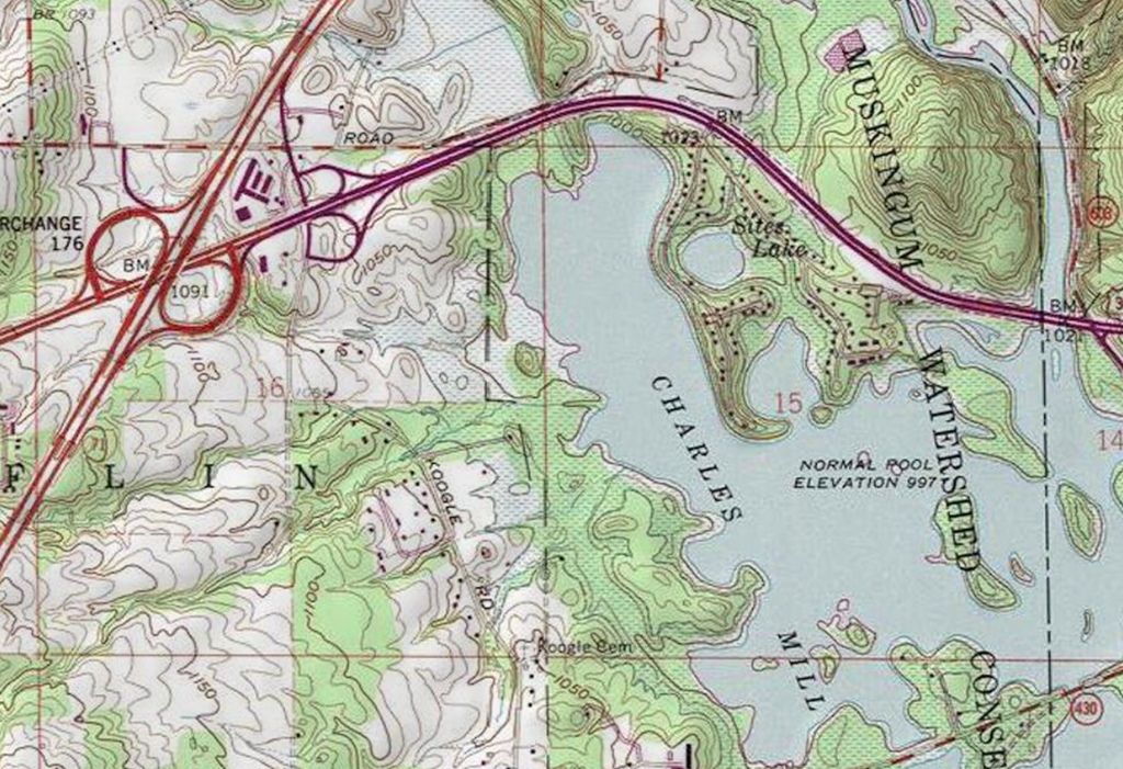
Then today in reading the history of Richland county, Ohio, I came across another story of a catastrophic drop in land which occurred in 1846 in an area about seven miles east of Mansfield. The area is now covered by several acres of water and is called Sites Lake – a small lake lying close to and north and east of the much larger Charles Mill Lake. But according to the history, Sites lake, which used to be called Uncle Jonas’ Lake, was at one time only about an acre in size. The story explains that the area around the lake, amounting to about eight acres, was very flat and rimmed with “hills of gentle slope.” So the owner of the property, who was the Uncle Jonas after which the lake was named, decided he would drain the lake and recover an extra acre of farm ground. To achieve this goal, he cut a ditch through the only break in the hills lying around the flat acreage so the water could drain from the lake to the “Black Swamp” which lay to the east. He completed his work on July 25, 1846, and successfully lowered the water level by eight feet.
Imagine Jonas’ surprise when instead of gaining more flat, dry land, he found the flat area around his lake had dropped and became flooded with water. Only the tops of trees could be seen and eventually over time even these too sunk out of sight increasing the size of the lake to six acres. Neighbors from miles around reported feeling a “quake and tremble” at the time the land catastrophically sank. Then, through the years, the land continued sinking until eventually the lake reached a size of eight to nine acres.
Later in the 1900s work was done to significantly develop the area around Uncle Jonas’ Lake. Today it is dwarfed by the much larger Charles Mill Lake which, according to the Charles Mill Lake website, is 1350 acres in size.