 The Data Science for Social Good (DSSG) team, a group out of the University of Washington, has been involved in an effort to improve mapping of the pedestrian way. By making use of the work from the OpenSidewalks project, they created AccessMap – a trip planning tool for people with limited mobility. With this tool, people can find the most accessible path through a network of sidewalks connected by curb ramps and street crossings.
At this time, the tool has only been implemented in Seattle, but the group plans to expand to other locations. The data used for the project is a compilation of the following elements with sources noted:
- Base map – OpenStreetMap (OSM)
- Sidewalks and curb ramps – Seattle Department of Transportation
- Street crossings – DSSG Team
- Elevations – National Elevation Dataset, USGS
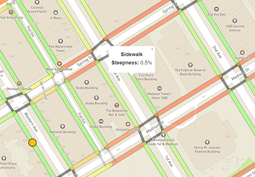
When a user clicks a sidewalk segment, the steepness or grade is displayed. The screenshot of the map above shows a sidewalk segment along 1st Avenue between Madison and Spring streets at a 0.5% grade. Sidewalk segments are also colored coded to indicate the grade with red exceeding the required 5%, yellow just below the requirement, and green meeting the requirement. Clicking a street crossing or crosswalk displays the steepness or running grade along with a "Yes" or "No" to indicate whether or not curb ramps are at the corners.
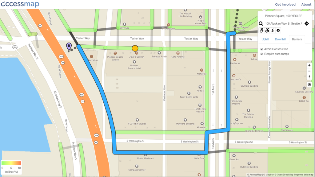
To plan a route using the map, the user types in their origin and destination in a manner similar to how other mapping programs work. The difference is that Accessmap has a drop down tool for the user to designate a limit for maximum uphill and downhill grade and the need to avoid construction and require curb ramps. Different mobility assisted devices such as wheelchairs or canes can also be designated. Below is an example of a planned route.


