The Day the FCC Took Broadband out of the Right of Way

Communications infrastructure in right of way

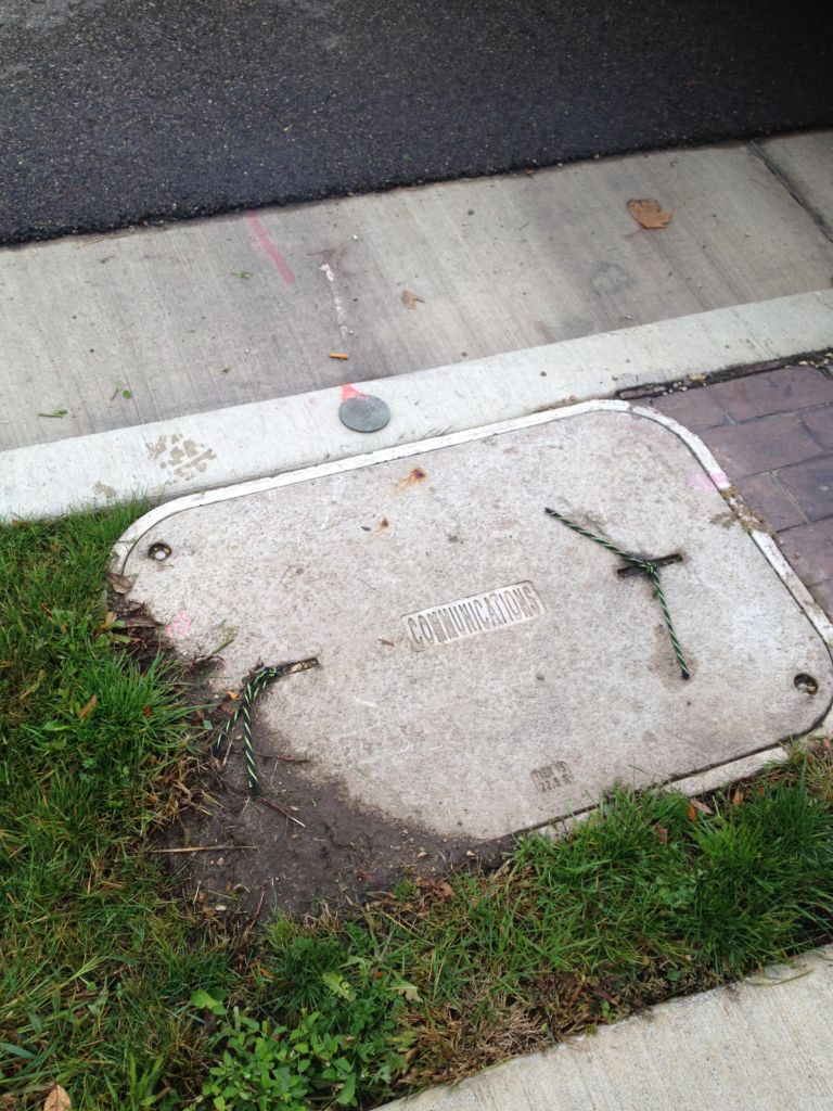
The use of public right of way is regulated by local or state government subject to local and state laws. Typically if a utility wants to install infrastructure in the public right of way, it must apply for and obtain a permit from the  government agency which has jurisdiction over the right of way. The installation and use of that infrastructure is then subject to the terms of that permit. Sometimes the issuance of the permit and the use is also subject to a franchise agreement negotiated between the local government and the utility. Utilities are also installed in utility easements which are designated on recorded plats of subdivisions. Private property owners typically own the underlying land which is subject to this easement. And the installation of the utillity in these easements is regulated by the local government through a permit and sometimes a franchise agreement. There have been additional regulations imposed through telecommunications acts. Often local government is restricted by these state or federal laws on the level of regulation that can be imposed on a public utility. Due to the telecommunications laws I have never heard of a use that was denied and instead have heard of court cases forcing cities to allow broadband companies to install their equipment in the right of way even when that installation was opposed by the city and the public.

Because the right of way and public utility easements are limited in area and because they are designated for public use, private parties are usually not granted permanent use of the right of way. Occasionally, limited uses are allowed such as street seating for restaurants or dog fences or sprinkler systems. In the case of use by a private entity, a legal agreement between the private entity and the local government is executed to permit the use. The local and state government has much more ability to charge fees and establish parameters for the use of public right of way when the applicant is not a utility or telecommunications company.

Keeping all that in mind, I can't help but wonder what will be the consequences of the FCC's net neutrality decision. From what I understand the premise of this action is the FCC is no longer going to define broadband companies as utilities and telecommunications. It appears instead the FCC's official position will be broadband companies are providing information services. Currently all of the major broadband companies have significant infrastructure in the right of way. Does this removal of a designation as a utility/telecommunication company mean local and state government can now regulate them as a private company? How about charge annual fees for use of the public right of way? And what about the infrastructure in public easements on private property? Is it legal for the company to keep its infrastructure in that utility easement? Can private property owners demand removal or payment? The next time a broadband company tries to install its Internet related equipment in my community, will the court again force the city to allow its installation as it did last time? Or since it's no longer a utility or telecommunication company, will the city prevail at denying the company access to the right of way?

With all the discussion online about the upcoming FCC decision, I've been surprised to see only one article touching on these issues and questions. The author of that article, "Ajit Pai's Net Neutraility Shell Game," suggested this reclassification will not take place and that this action by the FCC is only a ploy to force lawmakers into a position to concede even more power to broadband companies through additional telecommunication legislation. But if the FCC does end up moving forward with what they propose, I would expect eventually some local agency will test the legality of a broadband company's right to occupy the right of way. And if that litigation is found to have merit, permitting of right of way becomes a whole new playing field. 

Share

2017 National Engineers Week Educational Resources

2017 National Engineer's Week

An increasing number of STEM professionals have been flooding the market for the last decade, yet in the next ten years there will be a shortage of professionals in the field. The U.S. Bureau of Labor Statistics estimates that from 2012 to 2022, STEM employment rates will grow by 13%, higher than the 11% projected growth across all other occupations. And yet by 2025, the U.S. will need approximately one million more professionals than it will have produced.

Engineers Week is one step towards a solution to this conundrum. The 66th Engineers Week, which started on February 19th, is being celebrated in schools across the nation. With new initiatives such as the Future Cities Project and Girl Day, Engineers Week aims to inspire the next generation of engineers who will help steer the U.S. as a global leader in the fields of science, technology, engineering, and mathematics. Below you will see a number of academic infographics that showcase how the future generation of engineers can impact the world.

From 7.4 billion in 2016 to 9.7 billion in 2050, the world's population will continue to grow over the next decade, and the brunt of the baby boom will be centered around developing countries. The problem is that these same regions do not have sufficient infrastructure to cope with the rapid growth.

The challenge to bring basic infrastructure to the developing world now falls on the shoulders of the next generations of engineers. By having a STEM expertise, it will not only put them in the forefront of science and technology, but it provide them with the skills to steer the world towards a better future. To learn more about engineering infrastructure for the developing world, check out the infographic below created by Norwich University’s Online Master in Civil Engineering program.

Infographic - Engineering

Technological advances in transportation and information technology have resulted in a global tourism boom in recent years. The good news: the economies of both leading and emerging destinations have been positively impacted. The bad news: the rise in coastal tourism is taking a toll on the environment. The silver lining: the continuing surge in global coastal tourism has indirectly caused more demand for environmental engineering professionals.

Indeed, the next generations of environmental engineers will have to propose and develop sustainable coastal tourism solutions that aren't focused on doing the tourists a favor — they're literally saving the planet, one tourist destination, coast, and reef at a time. To learn more about how engineers can help build sustainable coastal tourism, check out this infographic below created by Ohio University’s Online Master of Science in Civil Engineering program.

Infographic - Engineering the Coastlines

Modern communication technology is one of the most promising fields of the future. From homing pigeons to telegraphs to status updates, the advances in modern communication have supported the advance of civilization for ages. At the heart of it all, electrical engineers are solving the real world problems that allow these communication technologies to function and progress.

What's next for the electrical engineers of the future? Will virtual and augmented reality communication be commonplace? Will the Internet of Things take over?

Electrical engineering has never been as game-changing a field as it is today. To learn more about electrical engineering's impact on communication, check out this infographic created by the New Jersey Institute of Technology’s Masters in Electrical Engineering program.

Infographic - Communications

Roads, bridges, and other critical infrastructures are the hallmarks of modern civilization. The bridges of today are not only a testament to the cultural aesthetics and norms of the period, but also the technological prowess of society.

However many of our bridges are crumbling and scouring due to several causes. We need a new generation of engineers to not only preserve the architectural symbols of our culture, but also adopt a modern approach to the renovation of existing bridges and planning of new ones. These engineers are ensuring the safety of the people using the infrastructure today and a century from now. To learn more about engineering strategies that prevent bridge failure, checkout the infographic below created by the New Jersey Institute of Technology’s Master of Science in Civil Engineering Online program.

Infographic - Bridge Scour

– by Austin Anderson, Circa Interactive

Share

3D Printing for Civil Engineers

3D Printer

3D Printer
3D printer
Lately I've been thinking our field might be missing out by not exploring the opportunities offered by 3D printing. Even though 3D printers have been around for many years, I haven't seen anything significant related to its use by agencies or firms in our field. I remember a 3D printer in use in a classroom at the college where I used to teach and that was at least 13 years ago. But that printer was used by the mechanical drafting students – not those in the civil technology field. So my partner and I have embarked on the goal of learning more about 3D printing and how the technology can be used in the civil engineering field.

Fortunately we found a learning program hosted by the University of Illinois in Champaign-Urbana which also happens to be our alma mater. The program is offered through Coursera and is a series of 5 courses leading to a specialization certificate in 3D printing. We began the first course right at the start of 2017 and are almost finished with the second one. So far the content has provided a good introduction to 3D printing and offered ideas about how it has been and could be used in many different fields.

Near the end of the second course, we were introduced to Josh Ajima, a teacher in Northern Virginia. In his presentation, he described how he created 3D representations of the earth's topography to visualize how different areas of a watershed relate. A description of his work with fabricating the Chesapeake Bay Watershed can be found in his article, "Design Challenge: Chesapeake Bay Watershed." Civil engineers can see right away how 3D printing an area's topography can lead to better understanding of watersheds, flooding impacts, material transport, and other related concepts.

Then, in our effort to learn more about the local 3D printing community, we attended a workshop at the Maker Lab in the Harold Washington Library in Chicago. There we saw a printout of the topography of the bottom of Lake Michigan. We were also introduced to the idea of using 3D printing to display data. An example of this type of use can be found on a 3D printing site called Thingiverse where the user anoved has uploaded a model of the United States to be used to visualize data sets for the states. A screenshot of anoved's Thingiverse page with the map is shown below. We can imagine an agency using this model for public education to show the amount of transportation funding spent by each state or the number of highway fatalities or miles of roadway.

Thingaverse Example of US 3D printed map with data

I'll continue to share our experiences with 3D printing as we learn more about the technology and increase our understanding of how it might fit into civil engineering. In the meantime, if you are interested in learning more, I'd encourage you to check out the classes on Coursera – they are free to take if you are not interested in earning a certificate for the specialization. You can also visit Maker Labs in your own areas – they are usually found in most larger cities, particularly in libraries. Also, if you know of any uses of 3D printing in our industry, we'd love to hear about them – just drop us an email, comment below, or reach out to us on social media.

Share

Mapping the Accessible Path

Access map screenshot showing sidewalk steepness at 0.5%

Access map screenshot showing sidewalk steepness at 0.5%The Data Science for Social Good (DSSG) team, a group out of the University of Washington, has been involved in an effort to improve mapping of the pedestrian way. By making use of the work from the OpenSidewalks project, they created AccessMap – a trip planning tool for people with limited mobility. With this tool, people can find the most accessible path through a network of sidewalks connected by curb ramps and street crossings.

At this time, the tool has only been implemented in Seattle, but the group plans to expand to other locations. The data used for the project is a compilation of the following elements with sources noted:

  • Base map – OpenStreetMap (OSM)
  • Sidewalks and curb ramps – Seattle Department of Transportation
  • Street crossings – DSSG Team
  • Elevations – National Elevation Dataset, USGS

When a user clicks a sidewalk segment, the steepness or grade is displayed. The screenshot of the map above shows a sidewalk segment along 1st Avenue between Madison and Spring streets at a 0.5% grade. Sidewalk segments are also colored coded to indicate the grade with red exceeding the required 5%, yellow just below the requirement, and green meeting the requirement. Clicking a street crossing or crosswalk displays the steepness or running grade along with a "Yes" or "No" to indicate whether or not curb ramps are at the corners.

To plan a route using the map, the user types in their origin and destination in a manner similar to how other mapping programs work. The difference is that Accessmap has a drop down tool for the user to designate a limit for maximum uphill and downhill grade and the need to avoid construction and require curb ramps. Different mobility assisted devices such as wheelchairs or canes can also be designated. Below is an example of a planned route.

Planned route example on accessmap

Share

Gamifying and Crowdsourcing ADA Inspections

Project Sidewalk Mission Summary

The Makeability Lab at the University of Maryland is on a mission to "collect street-level accessibility information from every street in the world and enable design and development of a novel set of location-based technologies for accessibility." In order to achieve this goal, they set up an interactive website where people can inspect, identify, and label accessibility issues along sidewalks and at curb ramps.

The accessibility issues generated by this site are fairly basic, but would still be very helpful to cities interested in quickly and easily identifying issues. Currently the site is focused on auditing infrastructure in the Washington, D.C. area.

The group also plans to use the inspection data collected to "create new types of map-based accessibility tools, such as AccessScore, an interactive map of a city's accessibility, and RouteAssist, personalized routing algorithms based on a user's reported mobility level."

In addition, they are using the labels people assign to issues to develop algorithms to allow the computer to automatically find accessibility issues in the future.

So far 218 people have inspected almost 400 miles or 37% of Washington, D.C. If you are interested in volunteering your efforts, you can visit their website at http://sidewalk.umiacs.umd.edu and click on the "Participate" button.

Project Sidewalk Participate Screen

 Before beginning, you'll be offered a quick tutorial. You can also create an account to track your contributions. Here are a few screenshots taken while I inspected about a half mile of sidewalk in the Bellevue neighborhood of Washington, D.C. The first shows a section of heaved and cracked sidewalk I labeled as a surface problem. You can see I was able to choose this option from the group of issue icons located above the street-view image.

Project Sidewalk Surface Problem

When you place an icon on the image, a box pops up as shown in the screenshot below to allow you to choose the severity of the problem. The site gives some guidance on this, but there is still a lot of judgment in assigning a rating. Initially I wasn't going to give this specific problem the worst rating, but then decided the slope looks severe enough I don't think a wheelchair would safely navigate across the heaved section. Below the rating, there is a space for a more detailed description of the problem.

Project Sidewalk Surface Problem Rating

The screen also shows which neighborhood I am in, where I am at on the street, how many miles I have audited and labels I have placed. As you complete assigned sections, the site summarizes your progress as shown below:

Project Sidewalk Mission Summary

Finally, you can view your dashboard to see your overall contribution to the site. Below is my current status after only working on it for a short time:

Project Sidewalk Dashboard

As you can see on my dashboard, the locations of the problems I found are displayed on a map. A zoomed in view of this is shown below. I was not sure if there was a way to see everyone's contributions, but if so, this would be very helpful to a city engineering or public works department in managing their sidewalk or street repair program. It would also be helpful if the data could be extracted from a given area so it could be overlaid in a city's GIS with other data such as land use, destinations such as schools and hospitals, and locations of capital improvements and developments.

Project Sidewalk Map Zoomed

Because the site is so easy to use, cities could also partner with schools and ask students to participate in inspections. This would help to engage students in their community and build awareness of the needs for and barriers to accessibility.

From what I can tell, the group also has the code for the site over on GitHub. Their license grants permission to make use of the software according the terms specified, and instructions for setting up your own development site are provided in a README file.

You can follow the group's progress through their Twitter feed: @umd_sidewalk.

Share