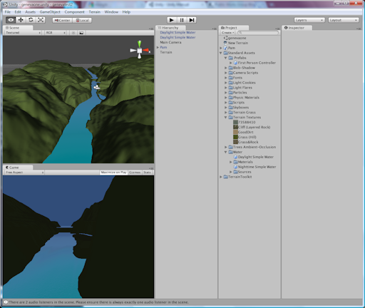
 Augmented reality (AR) has been gaining ground over the last couple years—most likely as a result of an increasing number of applications incorporating AR and an increase in the capabilities of supporting technology. But while the advances have been useful and impressive, I have not seen much related to the public works industry. This surprises me because AR could be incredibly useful and could increase efficiencies and decrease costs. So I thought I would post a few ideas of ways in which AR could be applied to the public works field with the hope that someone takes up the challenge and implements these tools:
Utility Locates:
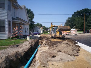
Utility locating can be a pain, but it is important to prevent damage to the utility or injury to people working near the utility. Current tools of the locating trade can include a map on a laptop or on paper, locating devices for accurately pinpointing the utility location, shovels, picks, probes, and paint or flags for marking the location in the field. The reason this task is so challenging is the need to rely on maps that many times are not accurate enough to allow the locator to just walk right up to the utility.
For example, a locator might have trouble finding a water shut off valve in someone’s yard if it is buried under snow or dirt. If there are accurate measurements to the valve, the locator uses a measuring tape and map to find the general location of the valve. And if there are not accurate measurements, which is often the case, the locator would have to randomly search the area with the locating device. Once a probable position is determined, the locator digs for the valve with a shovel. This can result in multiple holes being dug before the valve is found. If other utilities are in the area, readings can be inaccurate which makes finding the valve even harder. The whole process can be very time consuming.
Some cities have their valves in a GIS allowing the locator to walk to the approximate location with the help of a GPS device. This is very useful, but how much better and more intuitive would it be if the valve could be projected digitally onto the ground using augmented reality. The locator drives up to the site, gets out of the vehicle and puts on a headset or uses a mobile device, and all the utilities show up on the ground through the use of augmented reality.
Engineering Design:
Using this same idea, engineering design could be greatly simplified. If an engineer needs to improve a road by installing curb and gutter and a new storm sewer, maps must be collected and utilities marked in the field to designate locations of gas, electric, water, etc. Only then can the engineer determine the best place to put the curb and sewer. If all an engineer had to do was drive out to the job and use augmented reality, the best locations for the new improvements could be determined faster with more accuracy.
Engineers could also use this if a resident calls with a problem. Many times, when we respond to residents, we do not know exactly what the problem really is until we get to the site. So we might not have everything we need to determine if we can help with the problem. But if the resident had a question or problem related to a utility such as needing to tap onto our sewer or water or if they had a drainage problem and needed to tap into our storm sewer, I could not only determine right away if there was a feasible solution, but I could also show the resident by having them use the technology. Seeing the line on the ground would mean more to them than looking at a line on a map. And how much better it would be for them if we could animate the line somehow showing water flowing.
Maintenance and Construction:
Augmented reality could also be used to make sure crews are working on the right asset in the field. If we could digitally mark the manhole that needs to be fixed or the tree needing to be pruned, or the area in which I want landscaping planted, we could reduce confusion or errors in the field.
And if a contractor is installing a pipe, he could use augmented reality to see where he needs to dig. This could also assist the city in showing property owners where improvements will be made. Residents could use AR technology and actually see how the new road will look.
I could have also used AR when I was putting up the trim at my last house. This would have prevented me from drilling into a pipe or it could have helped me find the studs.
There are a lot of other uses we could figure out to help us better perform our job in public works. Hopefully this post helps generate some more ideas and maybe even challenge someone to develop an AR for public works tool.
 The rise of mobile devices has allowed everyone to discover what those of us in public works have always known – geospatial technology is cool! Now everyone wants to know where people and things are and how to find them. Games and other applications are being developed based on location-based information. And to meet this increasing interest, Penn State Public Broadcasting has created a media-based outreach initiative. Their mission is "to expand public knowledge about the history, applications, related privacy and legal issues, and the potential future of location-based technologies."


