

As a public works professional, one of the best things you can do in the new year is to check out ArcGIS Pro – a GIS mapping software by ESRI. I admit, like many GIS software products, ArcGIS Pro can be a little overwhelming to use right out of the box. Even though I am a regular user of ESRI’s older product, ArcMap, the user interface was nothing like what I was used to and the workflows somewhat different. But after trying it out for a few weeks, I have found ArcGIS Pro offers more effective features that increase flexibility, capabilities, and ease of use. It was definitely worth taking the time to figure it out.
If your workplace does not yet have a subscription, you can download a free trial to try it out. Because the new software is so different from past products, I went through the great tutorials ESRI has on their website to help me learn the software. After completing these trainings, I felt confident in making the switch to ArcGIS Pro for all of my GIS work.
The best way to explore what ArcGIS Pro offers is to download the software and use it yourself so I won’t try to lay it all out here in this post. Instead I included a few screenshots from the tutorials so you can get an idea of the layout and look. The data displayed is for Wellington, New Zealand and is provided by ESRI for use in the tutorials.
In the screenshot below, you can see the menus are displayed across the top in a manner similar to other Windows-based products. A content window is located on the left and lists the data included in the map. When you start accessing other menus such as catalog or symbology, they will show up in this same space. Then you can switch between them by clicking the tab for each located at the bottom of the window. In this image, I only have the content and catalog menus open.
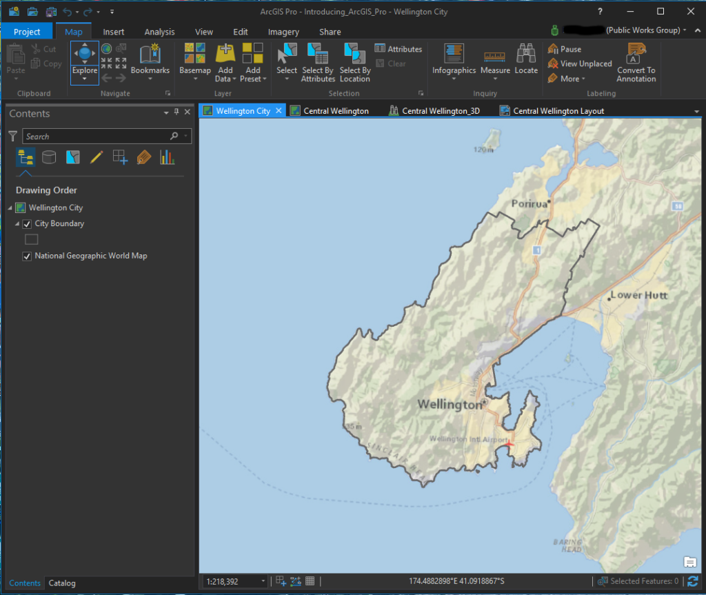 ArcGIS Pro screenshot of a 2D map
You can also see in this image several tabs shown above the map window. This is because ArcGIS Pro allows you to create multiple maps and layouts as a project rather than just creating one map at a time. With this format it is easy to switch between maps and layouts and copy data from one map to another. In the image below, a layout for this project is displayed.
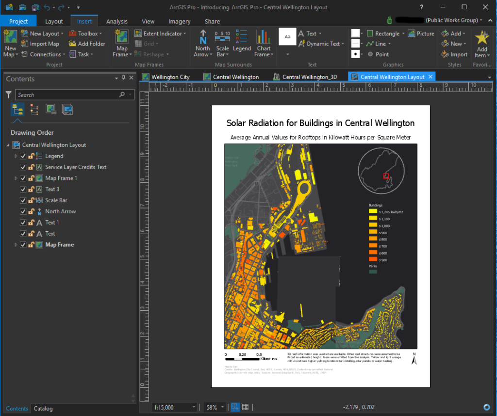 ArcGIS Pro screenshot of a layout
The other feature I really like is the ability to easily create 3D maps. Below is another screenshot of a map showing buildings in Central Wellington, New Zealand. This map displays the same data as shown in the layout in the image above, but in a 3D format. I clicked on one of the buildings to get a pop-out window of the information stored for that structure. Also I had changed the basemap to get an aerial view which displays more of a picture of the ground.
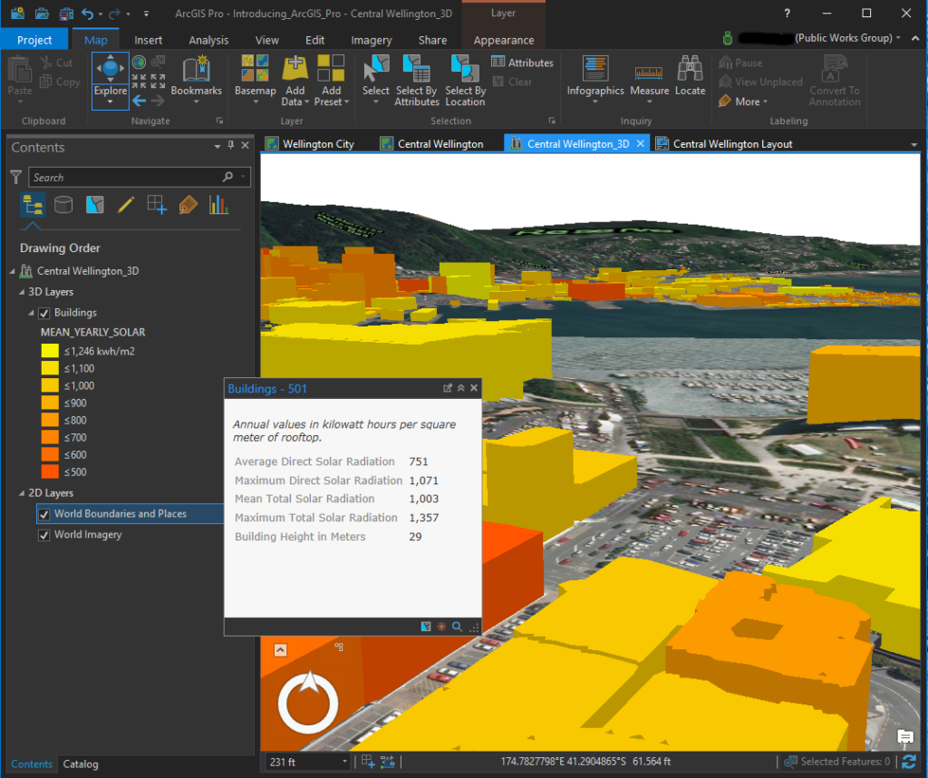 ArcGIS Pro screenshot of a 3D Map with data displayed
Finally in the screenshot below, I had clicked in the Analysis menu to display some of the tools available. You can customize these display windows to show tools you frequently use.
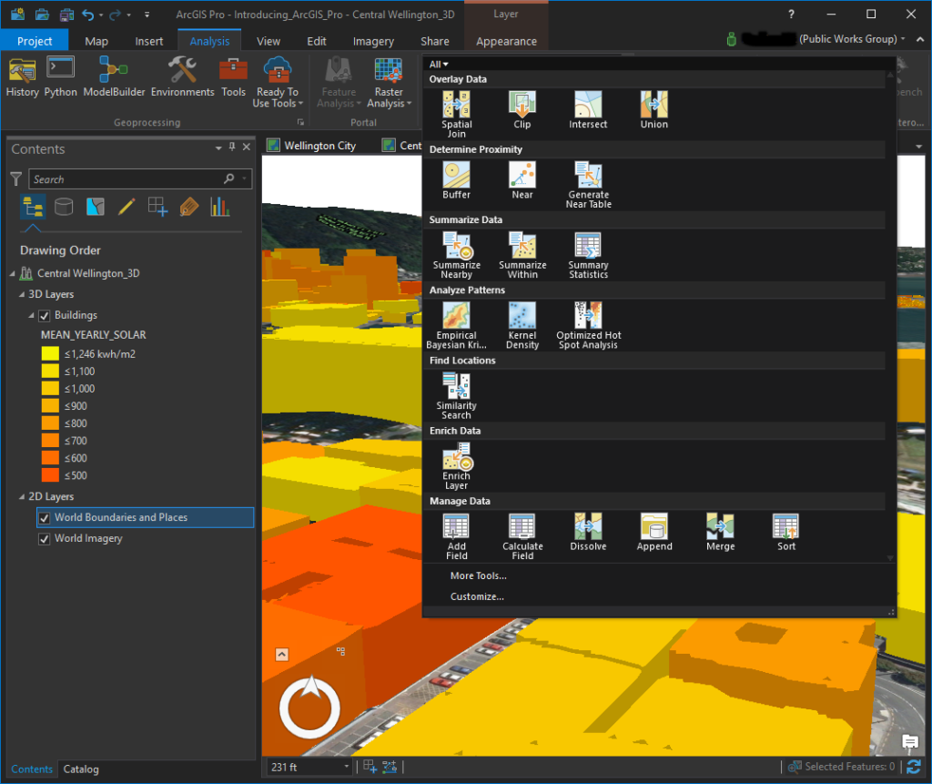 ArcGIS Pro screenshot of available tools in the Analysis menu
Another added bonus with ArcGIS Pro is the integration ESRI included between the software and ArcGIS Online. With the Share menu, you can easily copy your maps to your ArcGIS Online account where they can be displayed as web maps or used to create other applications such as story maps.
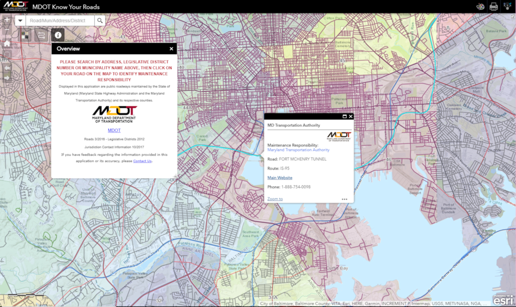
To give you an idea of why being able to easily share to ArcGIS Online is so important and powerful, I included just a couple examples of maps created and shared through that online service. The first is a very useful map created by the Maryland DOT. People can use this web map to figure out which entity has maintenance responsibility for any road in the state:
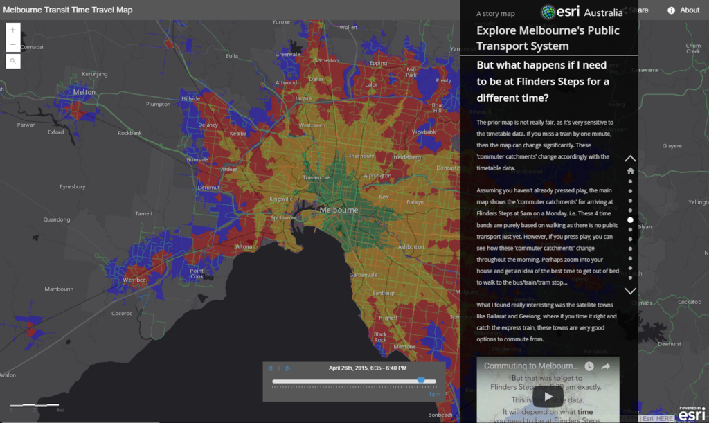
Another great example is this story map of public transit in Melbourne, Australia. This particular application displays a lot of the features and capabilities offered by story maps:
Finally, if your office doesn’t offer ArcGIS Pro for your own use or your free trial runs out, ESRI offers a fairly low-cost subscription option for people who just want access to the software for personal, non-commercial use. You can find out more about ArcGIS Pro for personal use here:Â http://www.esri.com/software/arcgis/arcgis-for-personal-use
