Setting Sustainable Water Rates

Water Distribution

Raising water or sewer rates is never a popular move, and in this economy many have tried to avoid it as if they are fleeing from a zombie apocalypse. But for many utilities expenditures are exceeding revenues, and there's sometimes little choice other than a rate increase. You can only cut so much from a budget before negatively impacting service levels and quality. But is this an unavoidable consequence of a bad economy? And can rates be set to sustain a utility even during times like these? Let's explore the history of rate structure, how it has impacted us today, and some solutions for going forward.

History of Water Rate Structures

In the U.S., there have been basically three types of structures or a mixture of two of the three:

  1. Uniform rates
  2. Increasing rates based on usage
  3. Decreasing rates based on usage

Some utitlities also applied a fixed fee in addition to the rate, but often this was not a significant amount. Water systems also created categories of users sometimes applying different rates to different users. Of the three structures listed above, number three was usually the more popular. After all, water was everywhere! And this was particularly true for cities with a large manufacturing base dependent on water for their process. It was almost as if utilities were begging people to consume water.

Based on stories I've heard from the "old timers," back then the water fund was never out of money. And they could always depend on it to carry the other funds. So what happened?

Water Rates & Water Funds Today

Our country has over the last couple decades transformed their view of water as an unlimited supply. Yes, water never really goes away, but it can become increasingly contaminated or placed into a state that costs significantly more to collect and improve its quality. So our view of water has changed to that of a valuable resource and commodity. And to encourage customers to conserve water, many utilities have changed rates to increase as water usage increases. At the same time, water regulations have significantly increased and only show signs of becoming even more stringent. The net result of all this is people using less water (yay! our conservation methods worked) causing a decrease in revenue (boo! we didn't see that coming!?) and the cost to collect, treat, and deliver water has skyrocketed causing an increase in expenditures. Then on top of that we had the recession with people cutting back even more on water just to save money or leaving behind vacant homes that generate no revenue for utilities.

Of course as they say hindsight is better than foresight. But it's surprising to me how many want to cling to the old ways going forward. Even as revenue is dropping and funds are bleeding, they continue to propose the old water structure of a decreasing rate based on increased usage. And many times with no fixed rate or a very small rate attached. This is simply not sustainable.

Implementing Sustainable Solutions

So what does work? This post cannot begin to offer the right answer for every situation. A good water rate study needs to be customized for each utility. But in general, a good beginning is to look at costs. Fixed costs that are truly independent of water usage need to be separated from costs that fluctuate with water usage. For example, if your water utility has two trucks, it has two trucks. If you normally pump 2 MGD and you change to pumping 1 MGD, you don't get rid of one truck if you still need two for checking your fixed system. Variable costs will include such things as chemicals and electricity.

In addition to costs, you need to look at your users. If you have categories of users such as residential, commercial, and industrial, these need to be analyzed as a group breaking each into usage blocks that make sense. It's also important to get a handle on the amount of usage expected throughout the year, particularly if seasonal temperatures fluctuate.

As you develop a good idea of water consumption in your system, you can start to explore which rate structure works best for your community. The community's philosophy on water consumption must also be taken into account. For some, a single rate independent of usage might best address the philosophy and the usage patterns. Because of water conservation efforts, some communities might choose to assess higher rates for increased usage. I can't imagine too many sticking with the less cost for more usage because this becomes a type of subsidy if source and treatment costs are high enough.

For many, it makes sense to meet variable costs with these rates and then add on a fixed fee that will pay the fixed costs. Doing anything other than this requires the rate to cover some of the fixed costs and puts the risk back on the utility because now the utility is dependent on water usage to be high enough to bring in extra money for fixed costs. It's also common to address low income populations or customers with minimum usage by offering a flat rate for the lowest tier of usage.

Although all that might sound straight forward enough, the real challenge occurs near the end of the analysis when you figure out what you really should be charging. Few utilities could probably implement the structure they really need immediately. One piece of advice is to set a target structure and then create a transition plan to get there. And whether you need to transition or not, it's best to create a long term ordinance establishing regular rate increases every year or every other year. This spreads the transition over a long time period and it allows for regular increases but offers elected officials the opportunity to amend an increase for specific years if possible.

Below is a guidance document from the EPA that can be used to assist in conducting a water rate study. And you can also find some good resources through AWWA publications.


Guide Small Systems Final Rate Setting Guide
 

Share

Delivering Public Works Content Through Video

Over the last few years, there have been an increasing number of public works departments, vendors, and organizations taking advantage of video sharing sites. This has been made possible by newer video cameras that now fit into a pocket and websites like YouTube. These new tools and technologies allow anyone to easily capture videos and upload them to the Internet. Fortunately for those of us working in public works, we not only can take advantage of these sites as viewers, but also as publishers of our own video content.

Today a search on YouTube for “public works” brings up 4,950 results. Of course not all are the type of “public works” we all know and love. But even after factoring out “Gotham Public Works” and art-related videos, we are still left with an awful lot of resources. Anyone can visit the site to watch videos. But if you create your own YouTube account, you can take advantage of many other abilities. People with accounts can add comments to individual videos, keep track of what has been viewed, create playlists and favorites, and connect to other social media accounts. For those intending to upload their own videos, YouTube also offers the ability to create and customize channels.

Some of my favorite public works-related channels are apwatv, Autodesk, CityOfCollegeStation, PublicWorksMagazine, TransportationTV, unitedutilities, and the one I set up at pwgroup. By subscribing to these channels, I can choose to receive notices when new content is added. I can also more quickly find content when I want to share it with others. With diminishing money in the budget for training, YouTube videos offer the ability to increase skills and knowledge at no cost, on demand, and without leaving the office.

Videos posted on YouTube are also easily shared by embedding or placing a viewer on another Web site. Below each video on YouTube is a “Share” button the viewer can click to share the video through e-mail, MySpace, Twitter, Facebook, and other social media sites. There is also an “Embed” button that when clicked will display a code. This code can be copied and pasted on any Web site to display a video player that will launch the video from that site. This is what I did to display one of my favorite public works-related videos below:


Companies and agencies can take advantage of this to regularly post videos with work-related content on their Intranet sites. Or if smart phones are used in the field, inspectors can consult a preset playlist of videos displaying proper construction methods.

For those interested in publishing, it really isn’t as difficult as it might at first appear. YouTube has an extensive help section to get you started. Of course, you will need some type of device to capture the video. While some phones now have this capability, you might want to use something like the Flip camera for this purpose. What I like about the Flip camera is it’s reasonably priced and easy to operate. There are two buttons ― one to turn it on/off and one to start/stop recording. To upload, I just use its USB connection to plug it into my computer. The software is part of the camera so I can plug it into any computer and the software is available. All of the more recent videos I have uploaded to my channel have been captured using my Flip camera.

While many agencies or companies are creating videos to offer information to the public, videos can also be created for internal training. A meter representative once spent about 10 minutes telling us how to take apart a meter. While I was able to write down what he said and create a guide using photos, it would have been better and easier to just video record his explanation and upload it to the computer. Videos can also be used to record underground utility crossings or other construction-related improvements, or examples of best practices. These videos can even be linked to a city’s GIS for later reference.

There are other video sharing sites besides YouTube such as Vimeo, Viddler, and even Flickr. If you are thinking of making your own videos, one of the best things you can do is watch what others have already done. And if you know of any great public works-related videos, make sure to send us the link!


Update: On April 12, 2011, Cisco announced they are discontinuing the Flip camera. Speculation has been that in an effort to reduce company costs, Cisco decided the Flip could no longer compete with smart phones.

Share

Augmented Reality for Public Works

Construction siteAugmented reality (AR) has been gaining ground over the last couple years—most likely as a result of an increasing number of applications incorporating AR and an increase in the capabilities of supporting technology. But while the advances have been useful and impressive, I have not seen much related to the public works industry. This surprises me because AR could be incredibly useful and could increase efficiencies and decrease costs. So I thought I would post a few ideas of ways in which AR could be applied to the public works field with the hope that someone takes up the challenge and implements these tools:

Utility Locates:
Utility locating can be a pain, but it is important to prevent damage to the utility or injury to people working near the utility. Current tools of the locating trade can include a map on a laptop or on paper, locating devices for accurately pinpointing the utility location, shovels, picks, probes, and paint or flags for marking the location in the field. The reason this task is so challenging is the need to rely on maps that many times are not accurate enough to allow the locator to just walk right up to the utility.

For example, a locator might have trouble finding a water shut off valve in someone’s yard if it is buried under snow or dirt. If there are accurate measurements to the valve, the locator uses a measuring tape and map to find the general location of the valve. And if there are not accurate measurements, which is often the case, the locator would have to randomly search the area with the locating device. Once a probable position is determined, the locator digs for the valve with a shovel. This can result in multiple holes being dug before the valve is found. If other utilities are in the area, readings can be inaccurate which makes finding the valve even harder. The whole process can be very time consuming.

Some cities have their valves in a GIS allowing the locator to walk to the approximate location with the help of a GPS device. This is very useful, but how much better and more intuitive would it be if the valve could be projected digitally onto the ground using augmented reality. The locator drives up to the site, gets out of the vehicle and puts on a headset or uses a mobile device, and all the utilities show up on the ground through the use of augmented reality.

Engineering Design:
Using this same idea, engineering design could be greatly simplified. If an engineer needs to improve a road by installing curb and gutter and a new storm sewer, maps must be collected and utilities marked in the field to designate locations of gas, electric, water, etc. Only then can the engineer determine the best place to put the curb and sewer. If all an engineer had to do was drive out to the job and use augmented reality, the best locations for the new improvements could be determined faster with more accuracy.

Engineers could also use this if a resident calls with a problem. Many times, when we respond to residents, we do not know exactly what the problem really is until we get to the site. So we might not have everything we need to determine if we can help with the problem. But if the resident had a question or problem related to a utility such as needing to tap onto our sewer or water or if they had a drainage problem and needed to tap into our storm sewer, I could not only determine right away if there was a feasible solution, but I could also show the resident by having them use the technology. Seeing the line on the ground would mean more to them than looking at a line on a map. And how much better it would be for them if we could animate the line somehow showing water flowing.

Maintenance and Construction:
Augmented reality could also be used to make sure crews are working on the right asset in the field. If we could digitally mark the manhole that needs to be fixed or the tree needing to be pruned, or the area in which I want landscaping planted, we could reduce confusion or errors in the field.

And if a contractor is installing a pipe, he could use augmented reality to see where he needs to dig. This could also assist the city in showing property owners where improvements will be made. Residents could use AR technology and actually see how the new road will look.

I could have also used AR when I was putting up the trim at my last house. This would have prevented me from drilling into a pipe or it could have helped me find the studs.

There are a lot of other uses we could figure out to help us better perform our job in public works. Hopefully this post helps generate some more ideas and maybe even challenge someone to develop an AR for public works tool.

Share

Inviting Utilities to the Public Works Feast

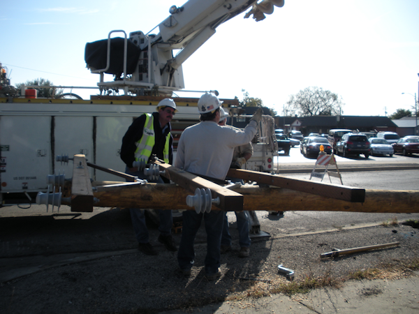
Public Utility Crew Setting a Pole

Yesterday, while our water crews were repairing a major water main break in our city, I spent some time talking with a guy from our local gas company. He had been sent to the site to watch out for the gas main that was located in the same trench. Our conversation made me realize that something important might be missing from President-elect Obama’s Public Works initiative: the impact this work will have on public utilities owned by non-government entities.

You can all relate to this. How many times does the gas/power/phone/cable have to move their lines or send out crews because we are constructing a project? And how many times do they beg you to let them know about work a year in advance so they can budget for it? And how many times do you wonder about building brand new pavement over gas/power/phone/cable lines that are ancient and prone to malfunction? Now imagine $700 billion worth of work being done in 12 to 18 months time with only a few months notice. You know public utilities have not budgeted for all the relocations and other work that will be necessary to construct $700 billion worth of improvements.

So what is the answer? The public works initiative is a great plan to get America back to work and at the same time rebuild our infrastructure. But we need to remember that public utilities have the potential to be severely impacted by this work. They need to be at the table with us as we move forward. If we don’t address their costs with this stimulus package, these extra costs could be passed onto consumers. Allowing them to access funds will ensure these projects will be done in a timely manner and will put even more people to work. For the public works initiative to be successful, I think we need to move over and get some more chairs.

Share

A Little Bit of GIS in My Life

So today Rick Knights, technical service associate, with WTH Engineering stopped by to continue his work on helping us implement our city geographic information system, or GIS. Rick is a certified ENP or emergency number professional who is very familiar with how the 911 system works in the states. We began discussing the many intricacies of the 911 system, how it all evolved, and then started in on GIS – where we are at and where we are going. Wow – this was one of those conversations that begins low key and ends with a major revelation.

Because I am excited about the potential of virtual worlds and augmented reality and how it all fits with the GIS component, we began going down that road. Well, while we were debating the need for accuracy in determining parcel boundary data, Rick threw out this idea: perhaps someday, we would decide to develop parcel data to the point that it did accurately reflect the actual property boundary so that this data would then serve as the established property line. As a former land surveying technician, I was not too certain of how this would be received by that industry. But then when I entered the idea of using augmented reality, Rick brought up an intriguing idea of being able to project property lines onto the actual ground using that technology. How useful that would be when determining setbacks or resolving property disputes.

From there we went to using GIS data that is officially established and maintained by utilities and government agencies and running it through an augmented reality interface to create virtual lines on the actual ground.

Well for anyone who has worked construction, you realize what this could mean. Using the proper technology, you could arrange to project utility lines on the ground – both proposed and existing. With this technology, perhaps one day, I could PROJECT MY DESIGN PLAN DRAWN IN CAD FOR A PARTICULAR AREA ON THE ACTUAL GROUND ON WHICH IT WILL BE BUILT! Then I could walk around making sure everything fit with existing grades, structures, etc. And I could better show the residents who always want to know, “how far is the road going to be widened into my yard?”

Having read about and looked into augmented reality, I cannot believe my mind had not already made this leap before! How useful that would be during the design and even the construction process. Can you imagine having the proposed sewer line projected onto the ground during construction so the backhoe operator can always see the alignment, along with all the other utility locations.

Perhaps others have already made this leap in the use of this particular technology, and I have just not yet come across it. So far everything I have seen has been about projecting a proposed building design on a lot for planning or projecting internal body systems onto a person’s outer skin. The idea of using this technology in the engineering and public works industry to virtually display designs and utilities on the ground or internal buildings systems on a wall is exciting to me because this is bringing the technology down to the level at which it becomes useful on a daily basis to city personnel.

So thanks Rick for the 911 info and help and that little extra promise that GIS can bring to my world.

Share