Using Google Street View for Engineering Submittals

Many people are probably familiar with Google Maps. This online tool offered by Google allows you to see an aerial view of a specific area and get directions and travel times from one address to another. Some might also take advantage of Google's "street view" which allows you to see a location as if you were standing there looking down the street. Of course, this is only available if Google has added street view capability to the roadway – in some cities it is still only accessible along major roads. But because we now have street view available on all the roads in our city, I've been using it quite a bit at work – it's a quick and easy way to check out features along a road. But the other day I discovered another very useful capability hidden within all that Google goodness and thought I'd share it in case someone else was like me and didn't realize it was there. 

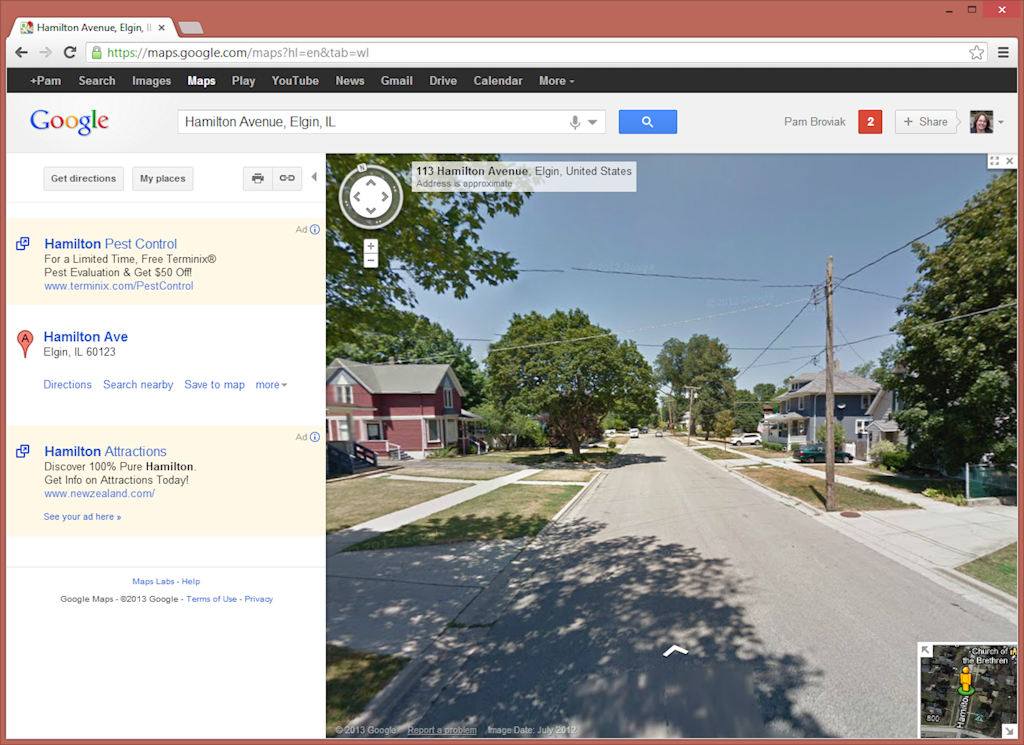
I was preparing a submittal for a project to be reviewed by a state agency and needed some photos of the street where the project was located. For this particular submittal all I needed was a general photo of the street that would show it was a typical asphalt roadway in a residential area. At first I looked to see if there was one available on the computer, but no luck. Just as I was wondering about having to go out and take some photos, I thought about using street view to see if that image would work. So I went into Google maps and dragged the little orange guy down from the upper left of the map to the road where I needed the photo. It was the perfect photo for my purpose. Using an example of an address in a neighboring city, I figured I would walk you through what I did and what I found. Here's how it looks when you zoom down to street view:

Google Street View

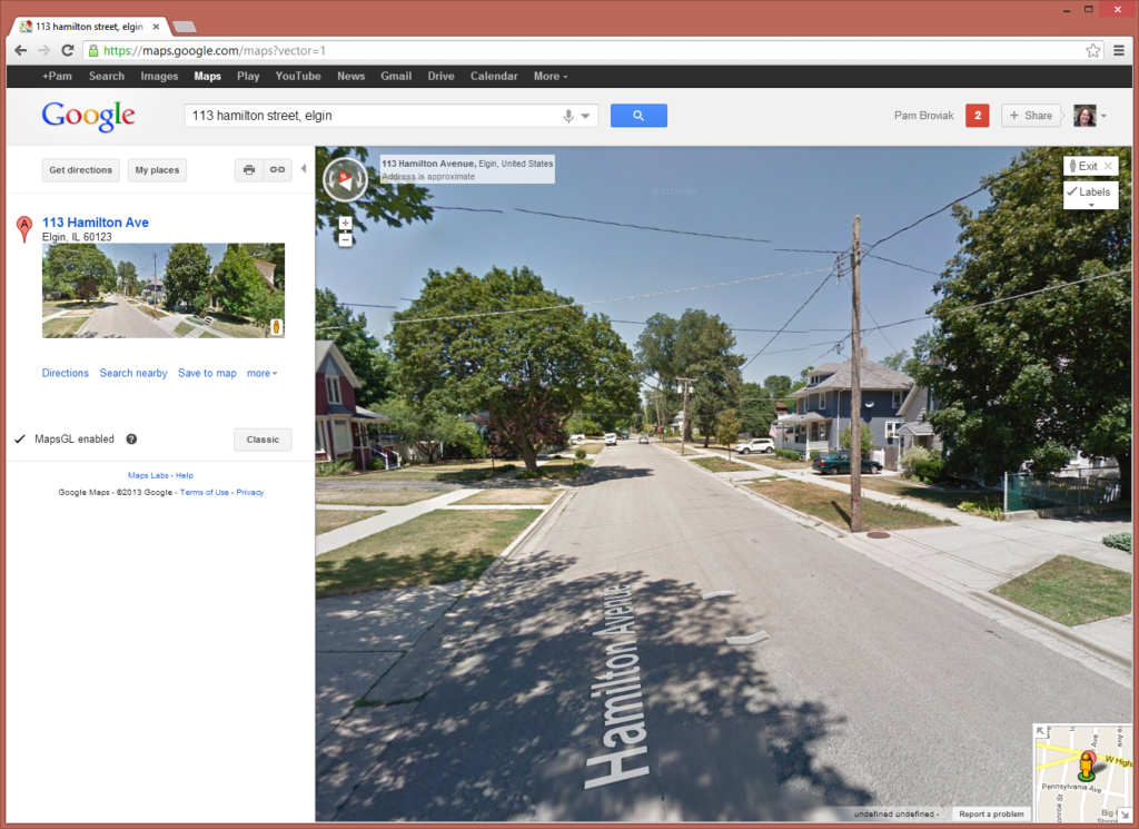
Now, that's a nice simple image that shows perfectly the type of image I needed to submit to this agency. I also noticed that Google offers an updated version of Google Maps called MapsGL so I switched over to that to try it out. You can see the difference below. One nice addition is the road name displayed on the roadway:

Google Street View MapsGL


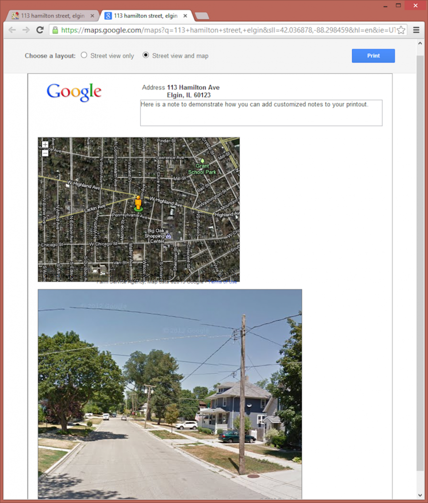
So just as I was trying to decide what program to paste this screenshot into for preparing an exhibit for the submittal, I noticed the print button. I figured let's see what it looks like – maybe I can get away with just using that. So I clicked the little printer icon and the following page was created.

Google Street View Printout

Wow – I thought, that looks pretty good. Google already has set it up on the page in a professional enough looking manner that I can just use that. They show the location and even offer the ability to type my own note and add any information the agency might need. (As an aside, I also noticed it looks like the latitude and longitude are displayed in the URL so if you needed that in the note, you could also copy and paste it from the URL.) But just as I was getting ready to print this from my browser, I noticed something else – Google offers another display option that includes the street view and a map. So I clicked the little button at the top of this page next to "Street view and map" and got the following:

Google Street View Printout with Map

How can you get better than that?! I have the perfect photo and a map all displayed in a simple and nice manner on a page that is all ready to print out by hitting that blue print button. Can it get any easier than that!? Maybe it seems silly to get so excited over something so simple, but for me, this saves the time it takes to go take a photo, download it to the computer, get it into a program, and create an exhibit. Sure it's not hard or difficult, but it does take time. I figured Google saved me at least a couple hours of my time the other day since I had four locations where I had to get this information. Doing it in this manner took only five minutes, and I have to admit, with the map, looks better and more professional than any of the past exhibits I have made for this same purpose. 

Go Google! Making us better engineers one little app at a time!
Share

Look Out! Driverless Vehicles are on the Horizon

After writing the other day about Google's car and the promise it holds for the future of our transportation, I was sent an awesome article written by Thomas Bamonte titled Information Becomes Infrastructure: Remaking the Highway Operating System in the Era of Smart Cars. Throughout the article, Bamonte, past general counsel for the Illinois State Toll Highway Authority, highlights many of the issues we will have to consider and the challenges we will have to face and solve as driverless technology spreads across the land. He also discusses many of the benefits to be realized by this innovative system and suggests possible funding mechanisms. It's definitely a must read for anyone working in the highway industry in any capacity. 


Share

Driverless vehicles – It’s Only a Matter of Time

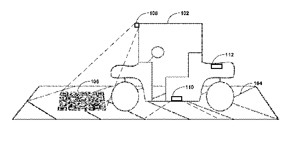
Google Autonomous Vehicle Patent Image


This month, Google received Patent No. 8078349 for "Transitioning a Mixed-Mode Vehicle to Autonomous Mode." The vehicle appears to be able to function in a driver-controlled mode, yet has the ability to be placed in a "driver-less" mode. When placed in this mode, the vehicle will use non-human inputs to monitor its location and proceed along a predefined path. When Google first applied for this patent, I saw some stories that did not seem to take this device seriously. I suppose it could be that as a society, we are so entrenched with the status quo when it comes to transportation that we cannot imagine anything other than what we have today. But for me, this is just one more sign that we are on our way to replacing cars with another type of transportation that does not require constant input and control by a human.

Google Autonomous Vehicle Patent Image

The key with the Google car is that it not only provides the promise of totally autonomous vehicles, but also the transition needed to get there. When I describe to people the thought of a personal rapid transit system run with either public or private cars, one of the questions has been how to transition to that system. And after seeing the Google car, it does seem to be a good solution. As infrastructure for autonomous vehicles is built out, we will need the ability to switch between modes in a manner similar to that used by the Google car.

And speaking of infrastructure, the other question or concern I hear, particularly from those in my field of civil engineering, is what will be used as a surface for these type of vehicles? I like to think it would not be pavement because I am not sure pavement as we have today is sustainable. Every year we spend an enormous amount of money and natural resources in just maintaining our roadways. And look at the difficulty Congress is having passing a highway bill. Not only can they not agree on what to fund and how much, but one of our main sources of revenue for highways, the gas tax, appears to no longer be viable or sustainable.

Add this in with the feedback we are hearing from the general public,

  • No more new roads
  • Reduce congestion and increase efficiencies
  • Reluctance to use public transit
  • More bike and pedestrian friendly roadways
  • Ever-present concern over drunk driving and now texting/talking while driving
  • Concern over waste generated from construction

and, if you deal with these restrictions every day, eventually you might start wondering just how long cars have left. Then if you begin to imagine how it could be with autonomous vehicles, PRTs, Google cars, or whatever you want to call them, you wonder why we are not at least talking about it. No one would ever have to worry about drinking/texting/talking and driving, and if you elevate the cars, you gain a tremendous amount of green space, save resources for other purposes, and don't have to worry about waste disposal from construction. People in the future will wonder how we could have used such a primitive system.

Yet, I don't hear these discussions from others in my field, and I worry that it will be another innovation that passes us by. If we don't at least monitor, understand, plan, think about our role in this transition, and work to become part of it, we will be left on the sidelines while a company like Google takes the lead on infrastructure design.

Share