Using Unity3D to Simulate a City

Most of my exploration of virtual worlds for engineering has been in Second Life and OpenSim. However, this year I have been looking more at Unity3D. Engineers are conservative and seem to dismiss virtual worlds like Second Life and OpenSim. Even though these programs are 3D modeling tools, they don't resemble nor do they use the typical CAD tools engineers are used to working with. Because Unity3D works well with these CAD tools and better resembles modeling programs, I suspect it will find greater acceptance by AEC groups.

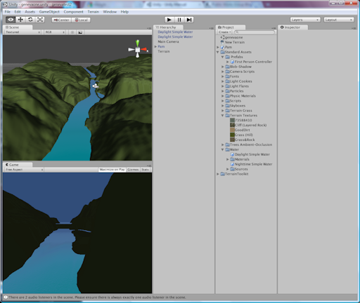
As an example of what can be done with Unity3D, I show below a crude example of importing DEM files into Unity3D. While the process is fairly easy, I still have some issues with the elevations looking too exaggerated, and there is an area that does not have contours. I also need to figure out how to apply the aerial images to the ground. So I still have a lot of work to do to refine this, but I thought it was pretty cool to be able to import contours and see the flat land transform immediately to reflect the topology of my city. I put some water in the model to indicate the river which helps to highlight the dam and islands. But I have yet to add any buildings, trees, or other features.

 Fox River Valley in Geneva, Ill.


Screenshot from Unity3D of Fox Valley River Valley through Geneva, Ill.


Another cool aspect of Unity3D is it can be embedded in a browser. Below is the static representation of what I created showing a view looking north through the river valley. Eventually I can add the capability for someone to travel through this model of my city with an avatar.

[WP_UnityObject src="http://www.publicworksgroup.com/images/stories/test1.unity3d" /]

Share

Augmented Reality for Public Works

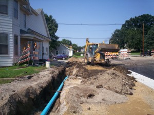
Construction siteAugmented reality (AR) has been gaining ground over the last couple years—most likely as a result of an increasing number of applications incorporating AR and an increase in the capabilities of supporting technology. But while the advances have been useful and impressive, I have not seen much related to the public works industry. This surprises me because AR could be incredibly useful and could increase efficiencies and decrease costs. So I thought I would post a few ideas of ways in which AR could be applied to the public works field with the hope that someone takes up the challenge and implements these tools:

Utility Locates:
Utility locating can be a pain, but it is important to prevent damage to the utility or injury to people working near the utility. Current tools of the locating trade can include a map on a laptop or on paper, locating devices for accurately pinpointing the utility location, shovels, picks, probes, and paint or flags for marking the location in the field. The reason this task is so challenging is the need to rely on maps that many times are not accurate enough to allow the locator to just walk right up to the utility.

For example, a locator might have trouble finding a water shut off valve in someone’s yard if it is buried under snow or dirt. If there are accurate measurements to the valve, the locator uses a measuring tape and map to find the general location of the valve. And if there are not accurate measurements, which is often the case, the locator would have to randomly search the area with the locating device. Once a probable position is determined, the locator digs for the valve with a shovel. This can result in multiple holes being dug before the valve is found. If other utilities are in the area, readings can be inaccurate which makes finding the valve even harder. The whole process can be very time consuming.

Some cities have their valves in a GIS allowing the locator to walk to the approximate location with the help of a GPS device. This is very useful, but how much better and more intuitive would it be if the valve could be projected digitally onto the ground using augmented reality. The locator drives up to the site, gets out of the vehicle and puts on a headset or uses a mobile device, and all the utilities show up on the ground through the use of augmented reality.

Engineering Design:
Using this same idea, engineering design could be greatly simplified. If an engineer needs to improve a road by installing curb and gutter and a new storm sewer, maps must be collected and utilities marked in the field to designate locations of gas, electric, water, etc. Only then can the engineer determine the best place to put the curb and sewer. If all an engineer had to do was drive out to the job and use augmented reality, the best locations for the new improvements could be determined faster with more accuracy.

Engineers could also use this if a resident calls with a problem. Many times, when we respond to residents, we do not know exactly what the problem really is until we get to the site. So we might not have everything we need to determine if we can help with the problem. But if the resident had a question or problem related to a utility such as needing to tap onto our sewer or water or if they had a drainage problem and needed to tap into our storm sewer, I could not only determine right away if there was a feasible solution, but I could also show the resident by having them use the technology. Seeing the line on the ground would mean more to them than looking at a line on a map. And how much better it would be for them if we could animate the line somehow showing water flowing.

Maintenance and Construction:
Augmented reality could also be used to make sure crews are working on the right asset in the field. If we could digitally mark the manhole that needs to be fixed or the tree needing to be pruned, or the area in which I want landscaping planted, we could reduce confusion or errors in the field.

And if a contractor is installing a pipe, he could use augmented reality to see where he needs to dig. This could also assist the city in showing property owners where improvements will be made. Residents could use AR technology and actually see how the new road will look.

I could have also used AR when I was putting up the trim at my last house. This would have prevented me from drilling into a pipe or it could have helped me find the studs.

There are a lot of other uses we could figure out to help us better perform our job in public works. Hopefully this post helps generate some more ideas and maybe even challenge someone to develop an AR for public works tool.

Share

Smart Tagging Engineering Plans

The city of Manor, Texas, has been successfully using QR codes for some time to convey information to citizens. And a while ago, I blogged about Microsoft tags – another method of conveying information through the use of a code and mobile reader. The Microsoft Tags have intrigued me because if you have time, you can create a code that can be “hidden” in your logo or another image.

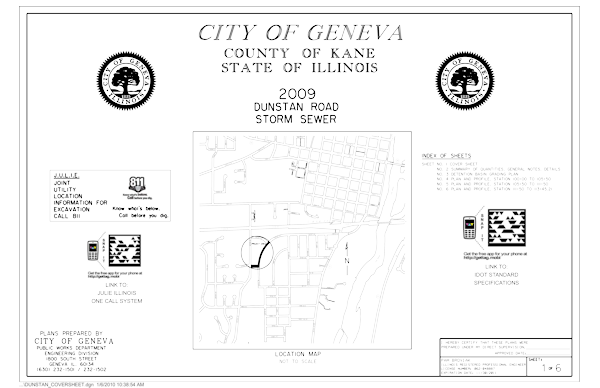
Unfortunately I was so excited about trying out the tags that I didn’t take the time to make a custom one. So I can’t demo how cool that would be, but I can show you an engineering-based use for these smart tags. Below is the cover sheet of the most recent set of engineering plans I prepared for a small sewer job we are constructing in my city. On the cover we placed two codes. One is displayed near the JULIE or 811 One-Call logo – by running the reader on your mobile and focusing it on this tag, your mobile is activated to call for a utility locate. Before actually calling, the number is displayed, and you are asked if you want to call.

Dunstan Storm Sewer Cover Sheet

If someone runs the reader on their mobile and focuses on the other tag, the mobile device is routed to the IDOT Website page displaying the State of Illinois Standard Specifications for Road and Bridge Construction. These are just two easy demonstrations of how these codes can be used in engineering and construction. I am sure with time, more ideas will arise. Feel free to comment below with your own ideas.

Share

Boots on the Ground: Building a GIS, Part 1

Introduction
I started building a GIS for my last employer in 1993. Because it was a part-time endeavor, we did not even get close to what I consider a full implementation by 2009. But I can say we at least had a GIS with some geo-referenced, verified data that could be used by all departments in the city.

Through it all I gained a good, first-hand knowledge of the challenges faced by each community undertaking this journey. So for some time I have wanted to share with you some down-to-earth insights and ideas. If you are an experienced GIS user, I would be very interested in hearing how your ideas or experience compares to mine and in having you share your insights. And if you are just beginning, I hope this helps to encourage you to begin and offers some basic guidance.

A Little GIS History
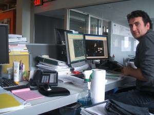
Drafting RoomEven though GIS has been around for decades in one form or another, there still seems to be a general misunderstanding and an awkward handling of this technology. In government and in particular in the engineering field GIS seemed to creep up onto unsuspecting drafting personnel. Just as they were getting used to making the transition from drawing with pen and paper to CAD, this new beast called GIS emerged.

CAD StationMoving to CAD had really only required the need to learn a new set of tools. And while this did have somewhat of a learning curve, at least the process and product was familiar. The information brought in by the survey crew remained the same: points, elevations, etc. The drawing format remained the same using the typical plan and profile format. Even maps were produced in the same style and format.

GIS on the other hand at first seemed to be from the realm of the planning department with initial uses focusing on zoning, corporate boundaries, land use, and parcel information. Perhaps this is why in many agencies GIS emerged from planning and has even remained under this department’s oversight.

So even though mapping seemed to always be grounded firmly in engineering, staff in some engineering departments did not initially embrace this new method of cranking out maps. A general lack of knowledge and awareness about GIS coupled with the need to learn yet another tool and the added challenge of changing an approach to how information is collected, presented, and maintained created too big of a leap.

However some engineering departments successfully made this transition because they realized early on the benefit of using this technology instead of CAD to represent utility information for water, sewer, electric, etc. And by now most engineering departments share this approach. But, the distinct difference in the drawing styles, delivery, and philosophy behind CAD and GIS remains, and this is where I believe the awkward handling of GIS in an organization begins.

This confusion and misunderstanding affects where GIS is located within an organization. While the engineering department has traditionally been the government office charged with map production, a quick survey of where GIS hangs its hat in each agency will reveal a variety of locations including engineering, planning, community development, IT, emergency response, police, fire, and even in a department completely on its own.

Another aspect of all this is the wide variety of GIS implementation between agencies across the U.S. Some are GIS rich with a wide range of data all geo-referenced, verified, and available to the public while others are GIS poor with little to even no GIS data available, collected, or offered. And there are many that would fit anywhere in between these two extremes.

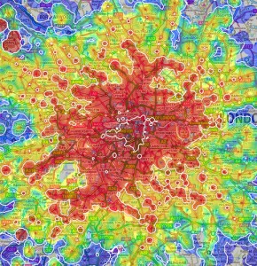
Multimodal Map of LondonWhy is this important to all of us? The awkward organization of GIS within an agency and the wide disparity of implementation? Because the world is fast moving beyond CAD and GIS into the next phase of information management. Those who haven’t figured GIS out or even worse, those who haven’t even begun are going to fall further behind. This difference in knowledge handling can be compared to one community having all dirt roads and another having interstate highways. And just as road conditions can affect growth and economic development so can the state of a community’s knowledge base.

Look for the next in this series: Starting to Build a Local Government GIS

Share

Reaction Grid: Building Community, Nurturing Business, and Throwing Tomatoes

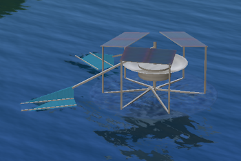
3-D Digital Aerator for Sewage LagoonBack in 2006, I decided to join and explore the Second Life community in order to find out how it could help me as an engineer. I was also interested in finding out how it could help promote our community. As I became more involved, I realized there was even more potential to virtual worlds than I had imagined. Over the years, I eventually saw more ideas and uses emerge.

However, the main community of Second Life is not there in order to develop engineering uses for this technology. And while there are some isolated examples of people using Second Life for serious business and there are many education-based communities, there still is not a large, organized community for developing engineering-related tools in-world.

Another challenge for me has been that Linden Lab, the company behind Second Life, does not appear to be focused on the use of their technology for engineering-related work. Many have asked for the capability to import/export CAD drawings and have received little to no support. Linden Lab also seems to waver and change their terms of service a lot making it difficult for people to make commitments for its use as a design or operating platform.

I had hoped that all of this would eventually develop, but instead what seems to have happened is that a group has migrated from Second Life Reaction Grid Welcome Areaover to another “grid” or virtual world called Reaction Grid. I knew the members of this group were more focused on the use of virtual worlds for business and engineering so I visited. Now I am hopeful that I have finally found the grid I had been searching for to help me focus on the engineering and business aspects of virtual worlds.
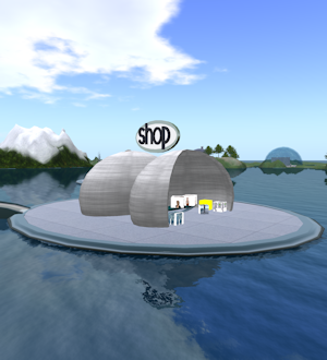
Not only are most of the residents of this grid very intent on using virtual worlds to enhance business, but the people running the grid are interested and involved in the projects that their residents are developing and working on. They are also involved in helping all of us better understand the technology behind virtual worlds.

I think this involvement in community, which is somewhat opposite of the hands-off approach of the Second Life grid, is important for several reasons. First, if we are to leverage this technology for our work, we need to have a good understanding of how it works and its capabilities. I like that the people running the grid have invested in hosting events and classes to help us in this endeavor because I think the faster everyone learns the technology, the faster the grid will develop.

Second, what this does is encourage more residents to also get involved in helping to move development forward, not only with their own projects, but with the grid as a whole. I think the ThinkBalm Innovation Community site ThinkBalm Site on Reaction Gridon Reaction Grid is indicative of this commitment to community. This group, which is dedicated to advancement of the Immersive Internet, is based on the collaboration and sharing of ideas.
Next, some of us who are interested in using virtual worlds do not have all the skills necessary to completely develop our own projects. Working within a grid that promotes involvement makes it much easier to find others who might be willing to help.

I recently had an experience that illustrates this: In an effort to show others in my field the benefits of virtual worlds, I have been trying to set up a simple 3-D SCADA. I know it can be done, I am convinced that this is where our operating technology will soon be for our water and wastewater plants, and I know it is something to which everyone in my field could immediately relate. But trying to find a programmer in Second Life who understood what I was talking about and who was willing to do this was impossible.
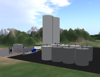
3-D Fuel Facility in Reaction GridHowever, over on Reaction Grid, there were several who immediately knew what I was trying to accomplish. The owner even built a demonstration project on the grid showing how a fuel facility could monitor fuel levels and then notify operations when the tanks needed to be refilled. Now I finally feel there might be a chance I will one day help introduce virtual worlds to engineers and operators using a 3-D SCADA demonstration.

One other attraction for me has been the approach that Reaction Grid has taken to building a grid. Instead of buying land and paying tier (tax) as we do in Second Life, on Reaction Grid, you can pay to host a sim which reminds me much more of how Websites are hosted and set up. That seems like a much more viable and long-term business solution for the creation and hosting of virtual worlds. Particularly now that the hypergrid technology has been implemented. Second Life is now a walled garden that you cannot leave while these other grids allow you to move from grid to grid just like we do between Websites.

Aside from all this business, I do have to admit, there is also an element of fun to virtual worlds that increases their appeal. And attending interesting virtual events does help to further connections and community. I think Second Life has a lot to offer along these lines, and even though Reaction Grid is more focused on business, they also incorporate Fright Night on Reaction Gridinteresting builds and fun events. One of the most entertaining events on the grid has been Fright Night – an event that is set up like a drive-in movie theater where we watch great, old, creepy shows and throw tomatoes at the screen. I know that is where I will try to be every Saturday night. And whether you are interested in developing an engineering project or throwing tomatoes at a movie screen, Reaction Grid seems to be the place to be.

Share

Losing Your Creativity

A couple weeks ago, I attended a meeting with our local business association to hear and participate in a discussion about tax increment financing districts (TIFs). Our TIF attorney made a comment at the meeting something to the effect that “infrastructure is not sexy.” At the time, I interjected my disagreement with his assessment; everyone laughed, and I really didn’t think much more about it until later.

But the more I thought about it, the more I had to admit that the general public would probably agree with our TIF attorney. Why is that? There was a time when people were impressed by the achievements of engineers and public works employees. Our contributions to bettering the lives of people were welcomed and appreciated. Now what we achieve seems to be taken for granted, dismissed, ignored, or worse yet criticized. Only within the confines of our own professional groups are these achievements awarded.

But most of us are not working each day trying to win an award or mass recognition for our designs or projects. So why should this change in attitude concern the average public works person?

The critical issue here is that this change in attitude seems to be leading to a complete dismissal of our profession as one that requires creativity in order to deliver a quality product. I realize that even amongst ourselves this may not be apparent because we really do not talk about ourselves or our profession as one that relies on creativity. But each day we face problems that rarely have obvious solutions, and the way we solve them is to tap into our creative abilities to assess situations, many times “think outside of the box,” and then derive the most efficient, acceptable, and cost effective solution that works. And we do this without even thinking about how we do it.

So if we are automatically doing this, why should we be worried about how others view us and our work? Because at one time, when the general public was still awed by our achievements, we were left alone to create, solve problems, and produce. As the world has progressed, this is no longer the case – the companies and agencies for which we work have made changes to staffing and policies that are now stifling the creativity on which we rely.

We now have supervisors who are not trained in our field and don’t understand the thought processes and work environments we need in order to achieve success. With fewer employees in our divisions and groups, we are pushed to achieve more in a shorter amount of time. Politicians often do not heed advice from professionals and experts in a certain field which leads to an imposition of policies and regulations that simply do not work.

I suppose there may still be a lucky few who have not had to experience these types of changes, but from what I can see and from the conversations I have with other professionals, there does not seem to be many of the lucky ones. Instead I hear of engineers who are having to “clock in and out” in a manner similar to that of a factory worker because some accountant for some government agency has decided that the employee might spend an extra 5 minutes or so at lunch.

For myself, I don’t have that problem, but I do have coworkers who are not in the public works department who simply cannot comprehend why I would need to work uninterrupted on anything. And they are unrelenting in their criticism should I try to just shut the door or not answer the phone for any time period at all.

So what is the result of these changes? I see and hear about designs and projects that no longer are the best or most efficient or even well thought out. This obviously leads to, at the least, increased construction costs and a waste of resources, and, at the worst, failures and a potential for loss of lives.

I agree that we as a nation need to invest more in infrastructure, and I think the average citizen would agree, but more importantly, should this funding one day arrive, we need to spend it wisely by coming up with the best designs. And this is only going to happen if we invest in our own creativity despite the obstacles trying to diminish this vital ability.

Next post – Finding your creativity.

Share